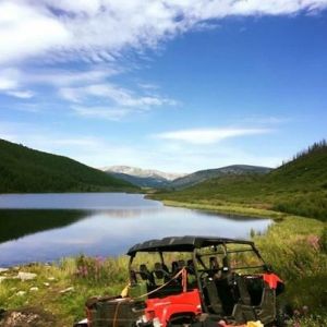
KHARA-KORUM & ERDENE ZUU Kharakhorum is a famous ancient capital city of Mongol Empire, was founded in the Orkhon valley by the order of the Great Chinggis Khan in 1220. It was completed by the second great Khan Ugudei and served as the Mongolian capital until Khubilai Khan moved the capital to Beijing. Kharakhorum was one of the most important city, cultural and religious center on the Silk Road. The City was famous its fountain in the shape of a colossal silver tree designed by the French sculptor Guillaum Bouchier. Silver tree simultaneously dispensed mare's milk from silver lion's heads, and wine, rice wine, bal (mead) and airag from four golden spouts shaped like snake heads. On top of the tree was an angel. After the collapse of the Yuan Empire, Kharakhorum was destroyed by invading Chinese soldiers in 1388. Its ruins lie in Uvurkhangai Province, 360 km to the south-west from Ulaanbaatar near today's town of Kharkhorin, and adjacent to the Erdene Zuu Monastery. They are part of the upper part of the World Heritage site Orkhon Valley. The symbolic ruins of Kharakhorum (kharkhorin), monumental walls (400 m of length) with 108 stupas, surround the first Buddhist monastery in Mongolia Erdene Zuu Monastery, built in 1586. In 1792, it housed 62 temples and 10,000 lamas. Most of the temples in Erdenezuu were destroyed during the 1930’s communism purges. TAIKHAR ROCK / TAIKHAR CLIFF/ This big 20-metres high big rock of granite stands on the vast plain uniquely. It is situated on a bank of Khoid Tamir River in Ikhtamir Soum of Arkhangai province. This cliff was formed by separating from the river bank due to millions of years’ continual flow of Khoid Tamir River through granite cape on its northern bank. Over 150 inscriptions (Turkic, Uyghur, Mongolian, Tibetan, Manchu and Chinese) were engraved on the cliff, but most of them seem to have barely appeared as time passes. The myth: There was a wide valley on the way to Zag Baidrag River after climbing over Khangai range. It is believed that a giant snake passed the valley crossing over 3 open canyons of Eg Mountain pass moving along the Khangai range until it reached the site of current Taikhar Chuluu and then fell into a hole under the cliff. After that, a well-known local wrestler knowingly covered the hole with a massive cliff, currently known as Taikhar Chuluu. KHORGO-TERKHIIN TSAGAAN NUUR NATIONAL PARK The National park is situated in Tariat soum in Arkhangai province, 580 km northwest of Ulaanbaatar. It has been protected since 1965, fully in 1994. Terkhiin Tsagaan Lake (Great White Lake) is a freshwater lake, located near the Khorgo extinct volcano in 2000 meters above the sea. Terkhiin Tsagaan Lake, is 16 km long from west to east and 6km wide from north to south, 60m depth and 61 square kilometer area. An immense mass of white-hot lava once blocked the Terkh River and it is water formed Lake. Terkhiin Tsagaan has more than 10 species of fish such as Taimen, perch, lenok, pike and many birds including swan, shelduck, duck, gull, common heron and great white egret. The Khorgo crater, situated at an altitude of 2210 meters with a diameter of 20 meters and depth of 70 to 80 meters. It's surrounded by Khangai mountains and erupted 8000 years ago last time.